En
 Fr
 De
 It
 Es
 Uk
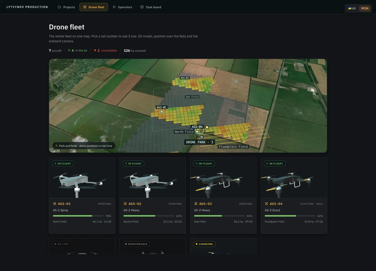

Our own R&D product for agriculture: a swarm of scouting and spraying drones that works a farm as one system. Fields are analysed from Sentinel-2 satellite imagery and drone flights, problem zones get a diagnosis and a treatment plan, and the fleet picks up the resulting tasks on its own - a task starts as soon as an aircraft frees up, without a dispatcher. Everything lives on one 3D map: seven aircraft in the air, their onboard cameras, the operators cleared to fly them and the work queue.
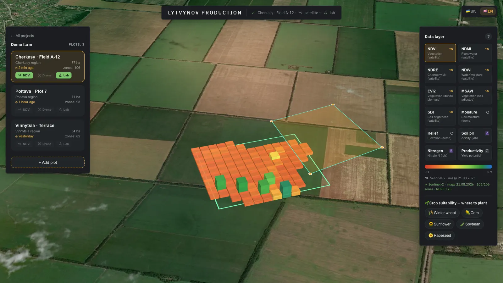
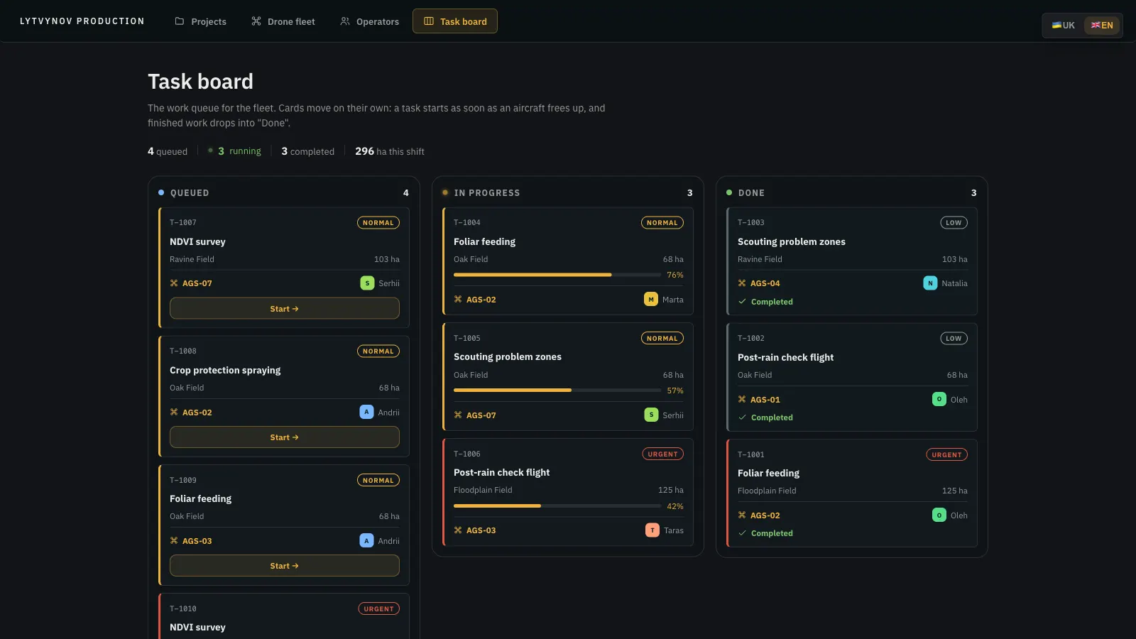
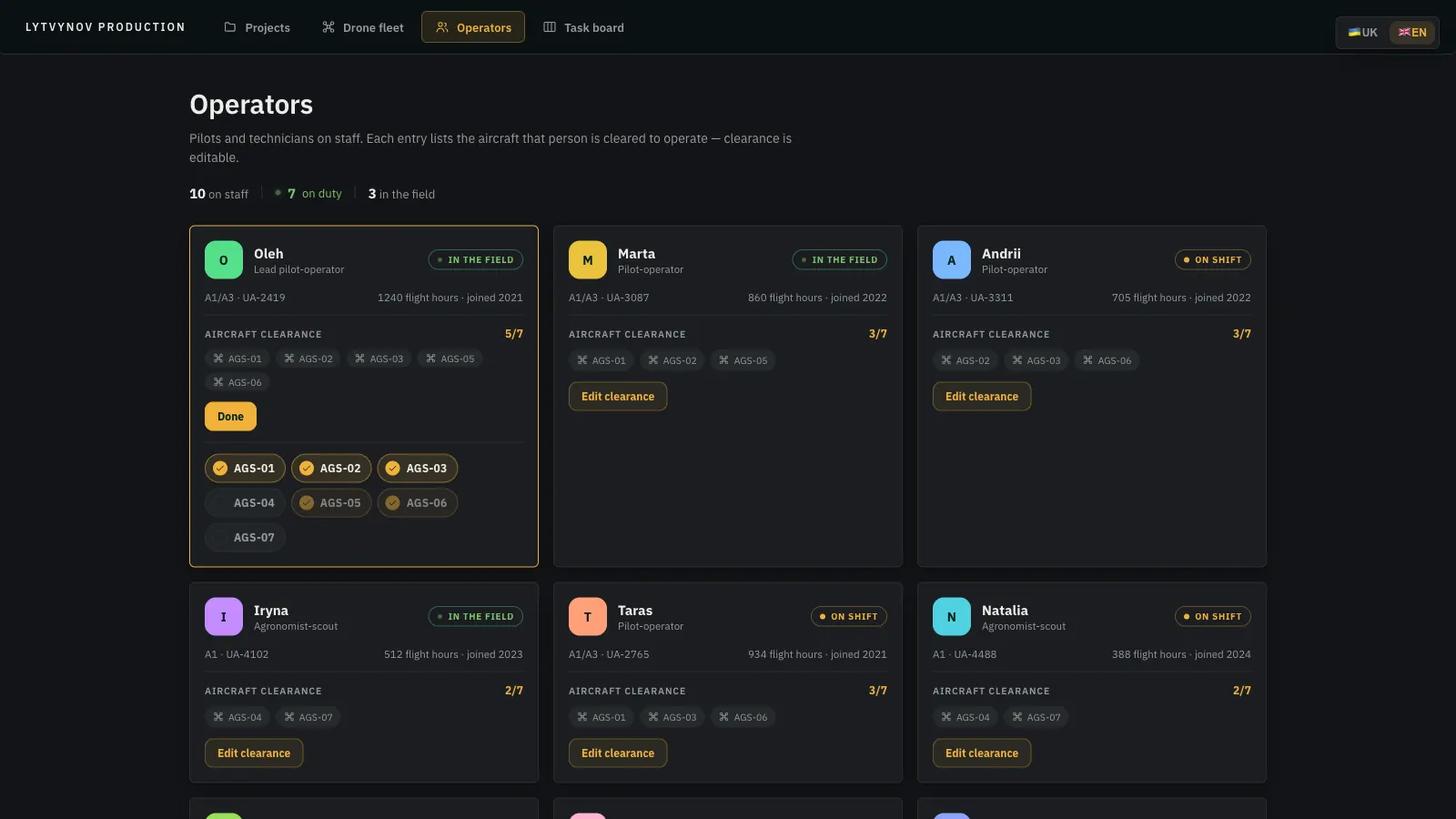
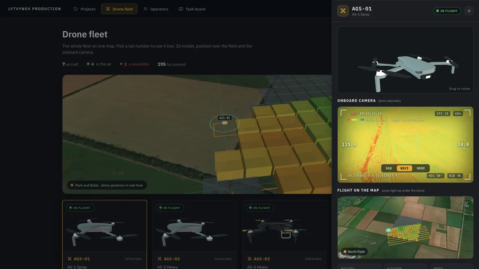
We built a browser-based ground control station on deck.gl and MapLibre over real satellite imagery: a live fleet map with 3D drone models and serpentine flight paths, a per-aircraft drawer with an onboard camera in RGB, NDVI and NDRE false colour, twelve data layers from Sentinel-2 and soil-lab samples rendered as extruded 3D zones, per-zone reports with fertiliser recommendations and savings, crop-suitability maps, a polygon tool to add new plots, a self-running task board and an operator directory with editable aircraft clearance. Ukrainian and English.
The prototype turned a stack of agronomy formulas into something a farm manager can understand in a minute: which zones are stressed, what to apply and where, what it saves against blanket application, and which drone is already on its way. The aircraft link is simulated for now - telemetry, flights and the task queue are generated - while satellite and weather data are real. It is the base we use to talk to agri-tech clients about swarm control, field analytics and variable-rate application.
Project overview
Industry: Agri-tech, precision farming, drone operations
Scope: Ground control station in the browser - fleet map, onboard camera, satellite and lab analytics, recommendations, task automation, operator clearance
Stack: React, Vite, zustand, deck.gl, MapLibre GL, glTF, Node.js, Copernicus Sentinel-2 API, Open-Meteo, Esri World Imagery
Data: Real satellite indices and weather; drone telemetry and task flow simulated in the prototype
Languages: Ukrainian and English
Key features we implemented
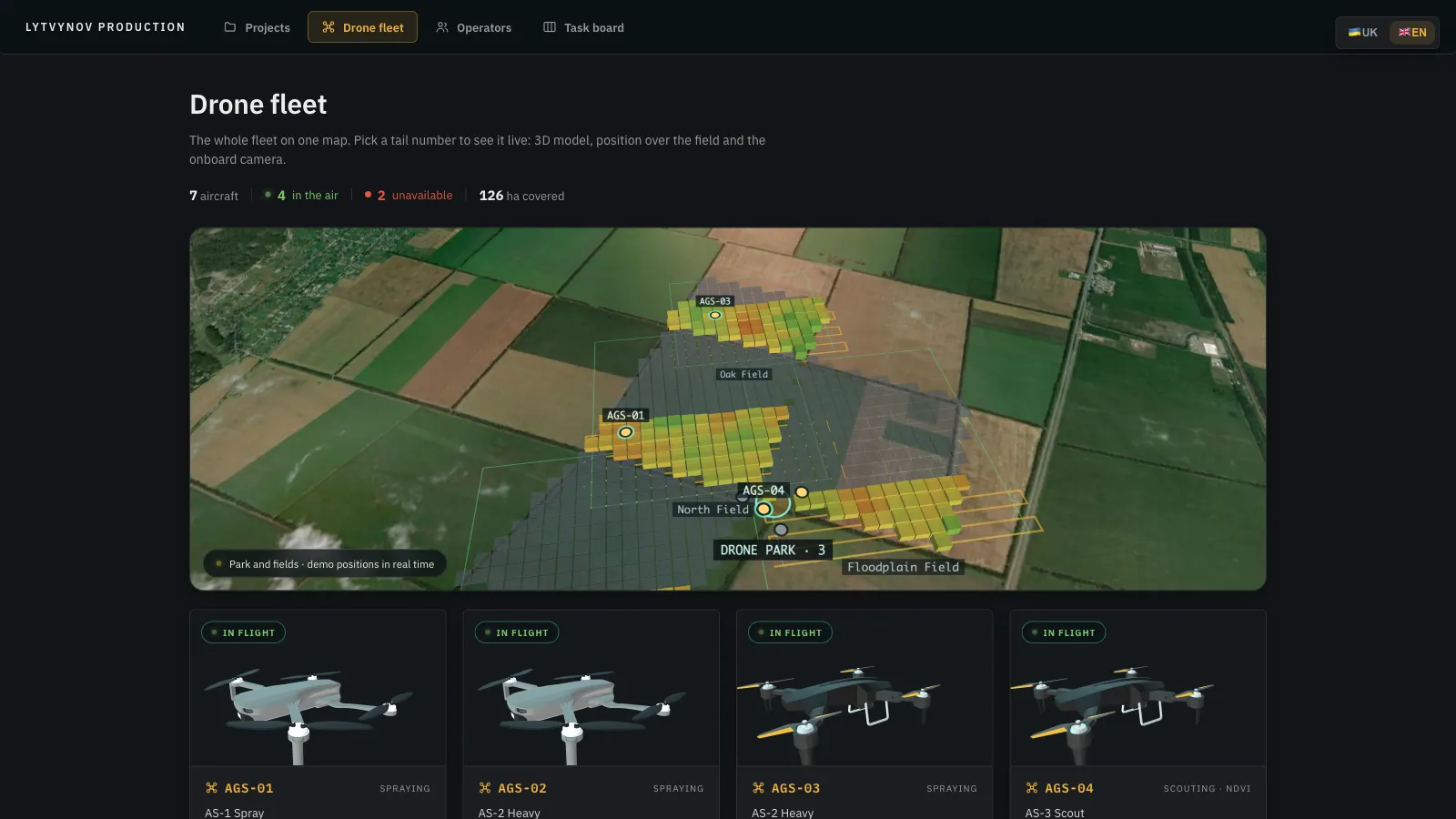
Swarm on One Map
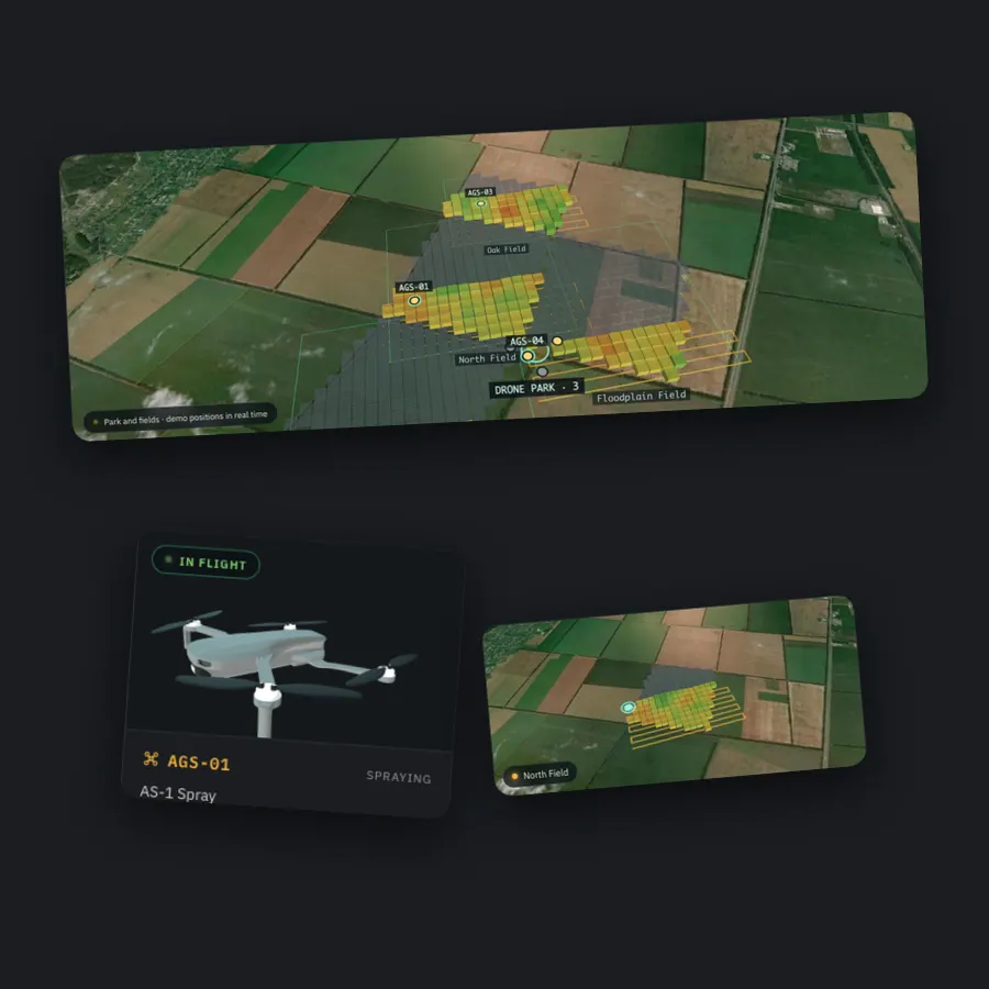
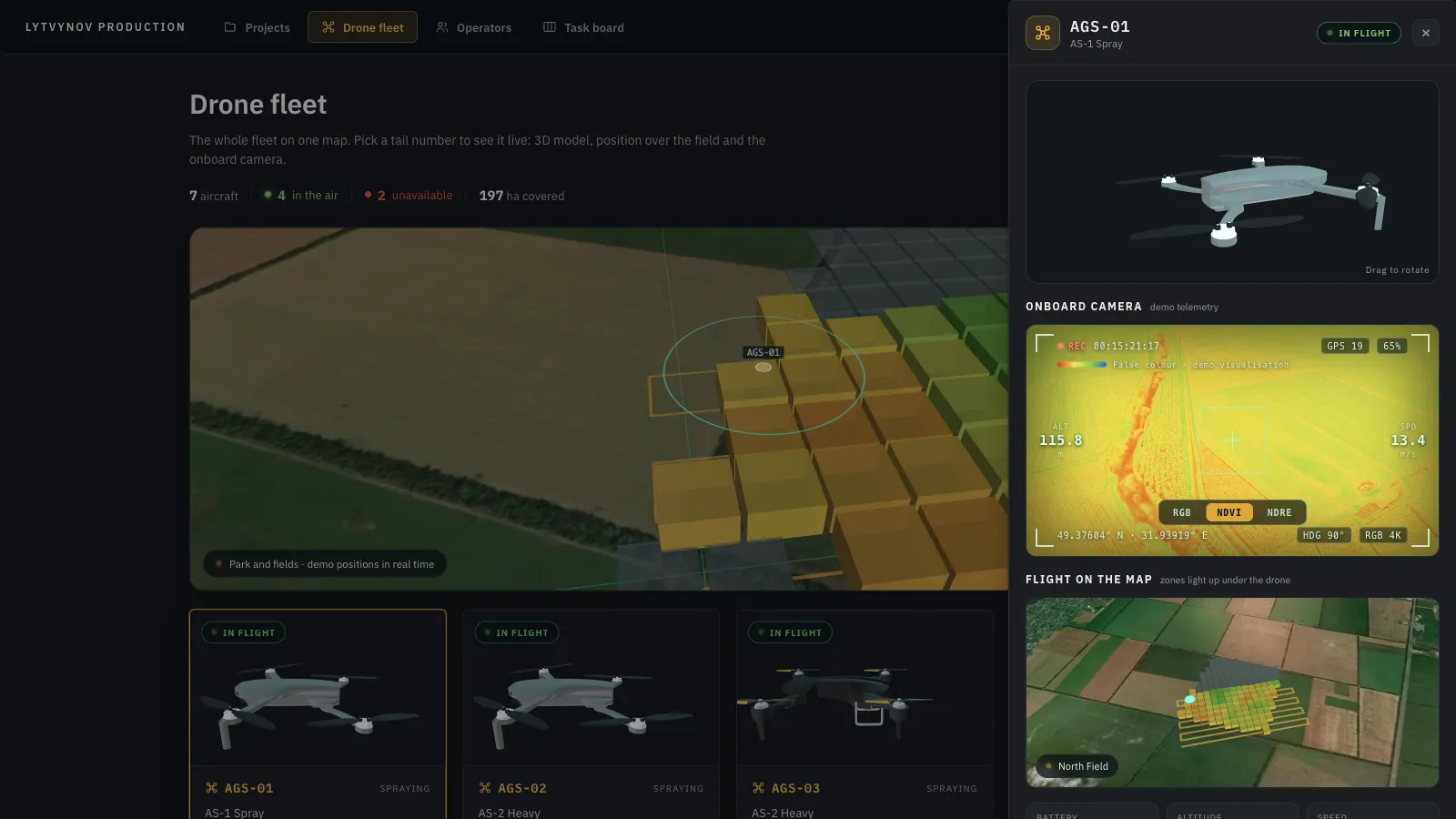
Seven aircraft over three fields as 3D models on their routes, with covered zones lighting up under each drone in real time.
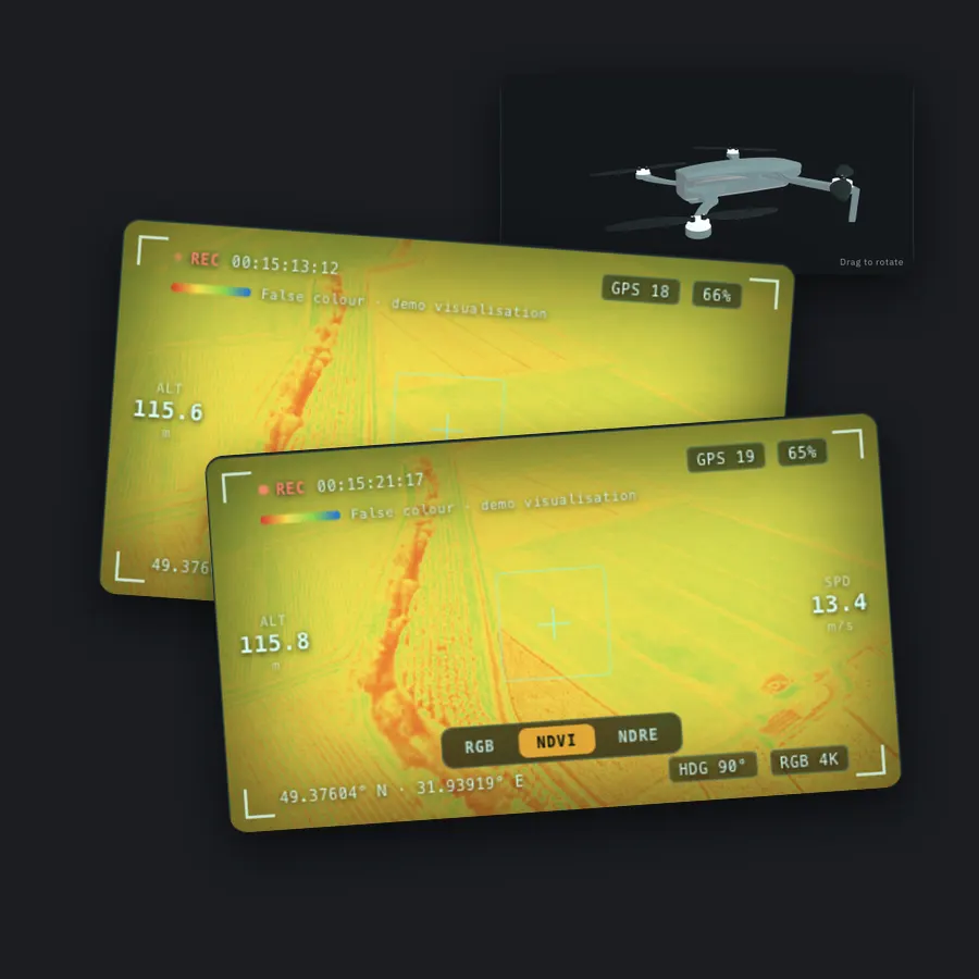
Onboard Camera & Telemetry
Per-aircraft drawer with the rotating 3D model, live camera in RGB, NDVI and NDRE, scan map, battery, altitude, speed and time remaining.
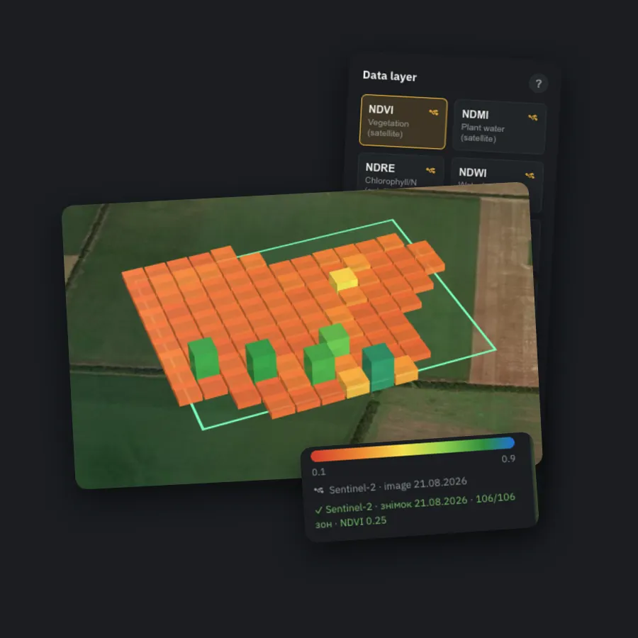
Sentinel-2 Field Analytics in 3D
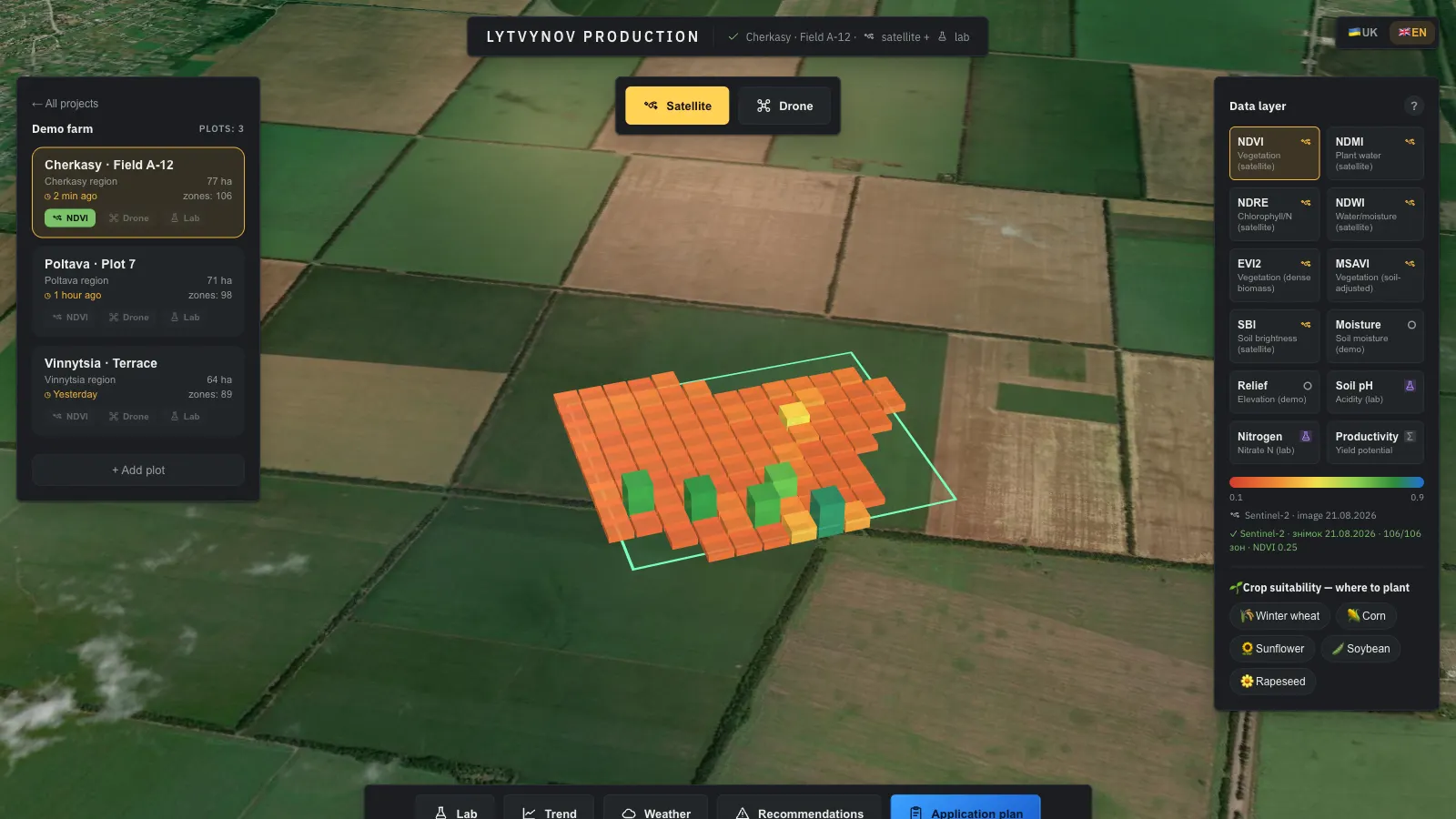
Seven satellite indices pulled from Copernicus and painted onto extruded 85 m zones over real imagery; drone and lab layers on top.
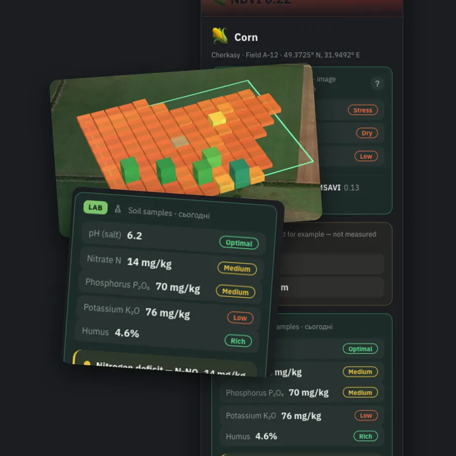
Zone Report & Soil Lab
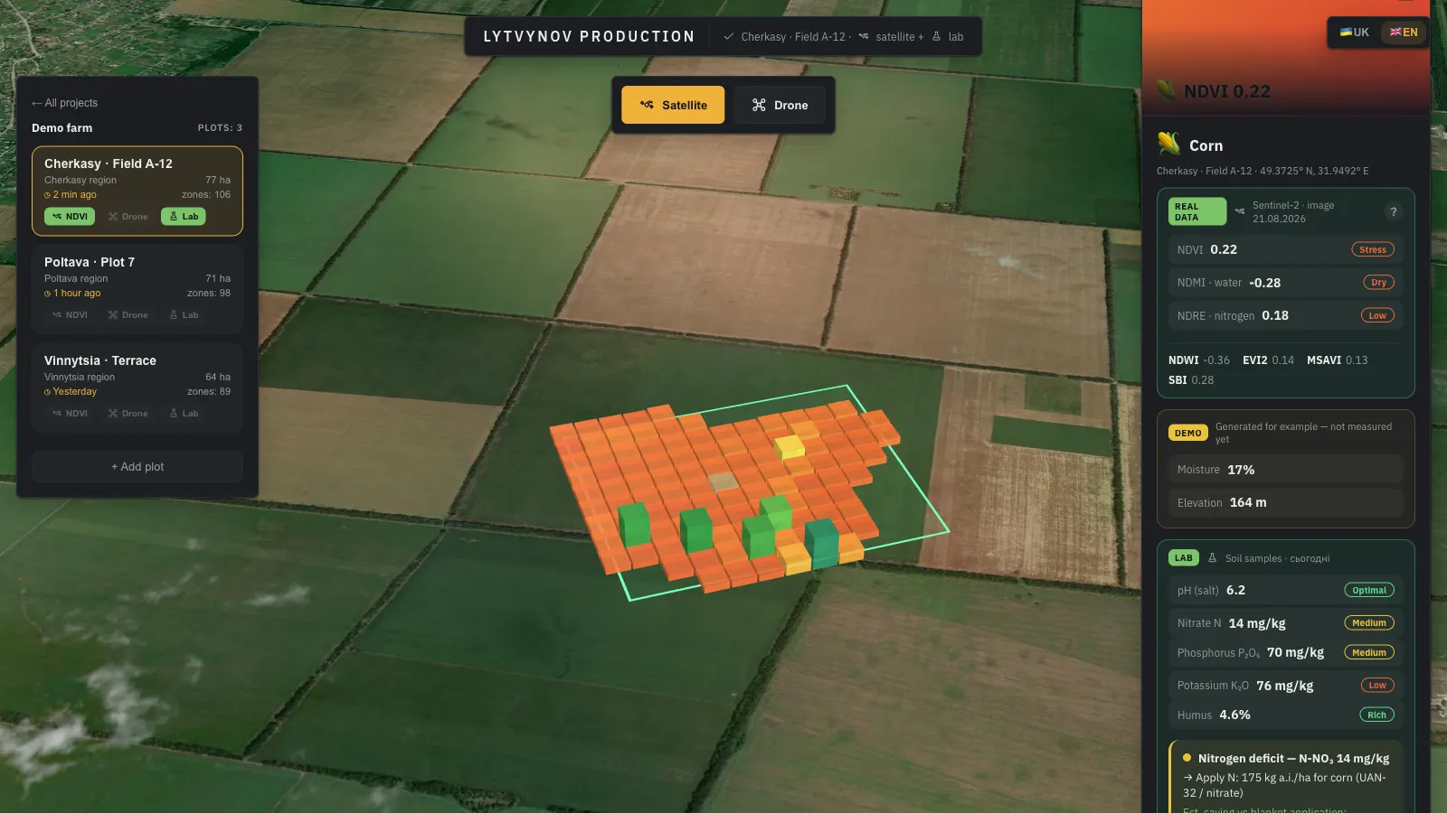
Click a zone: indices with status, pH, N, P, K and humus, a diagnosis, the dose for the crop and the saving versus blanket application.
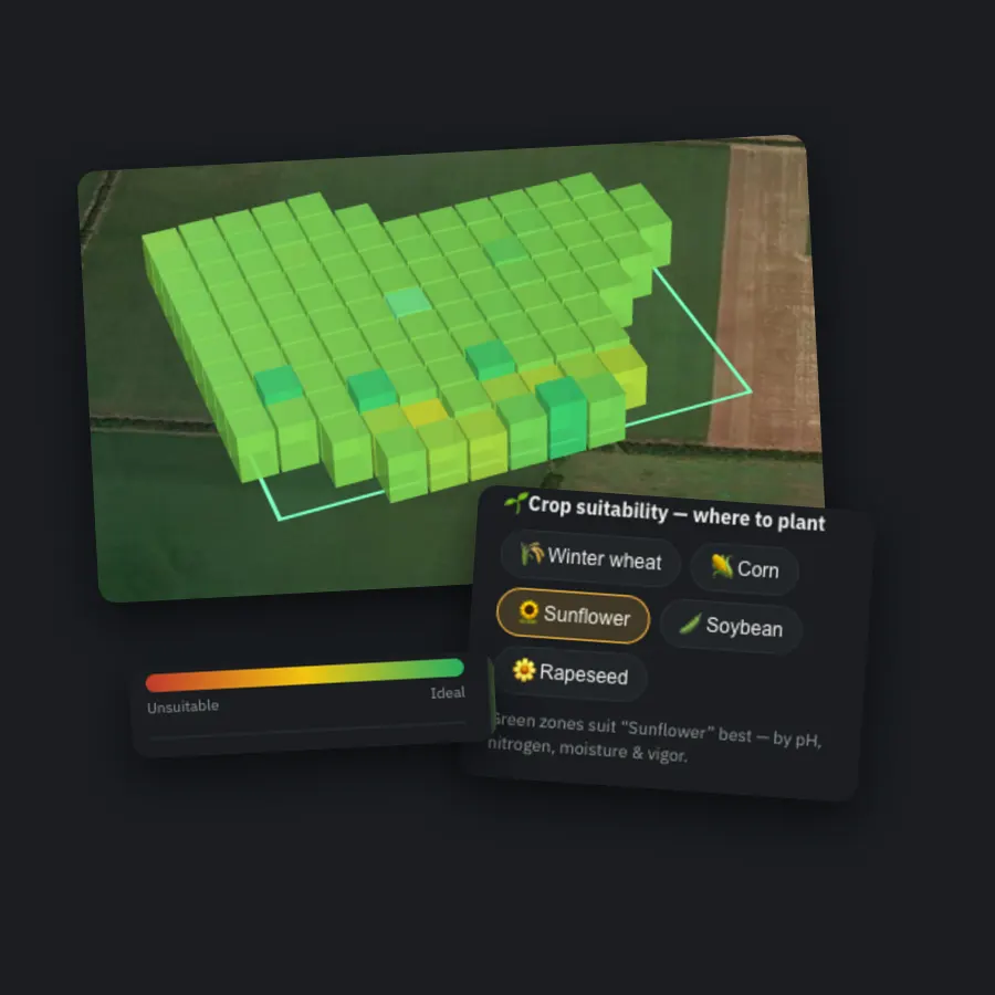
Where to Sow
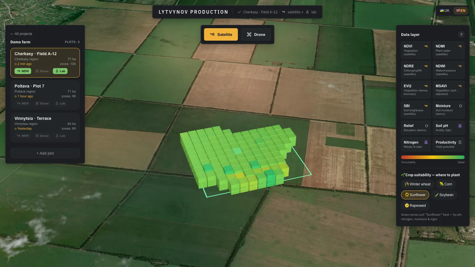
Crop-suitability model scores wheat, corn, sunflower, soybean and rapeseed per zone by pH, nitrogen, moisture and vigour.
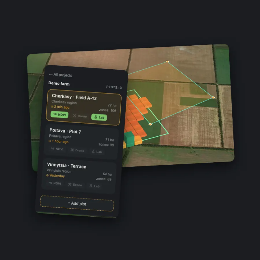
Add a Plot by Drawing
Outline a polygon on the satellite map, save it, and the new plot is zoned, analysed and added to the farm project.
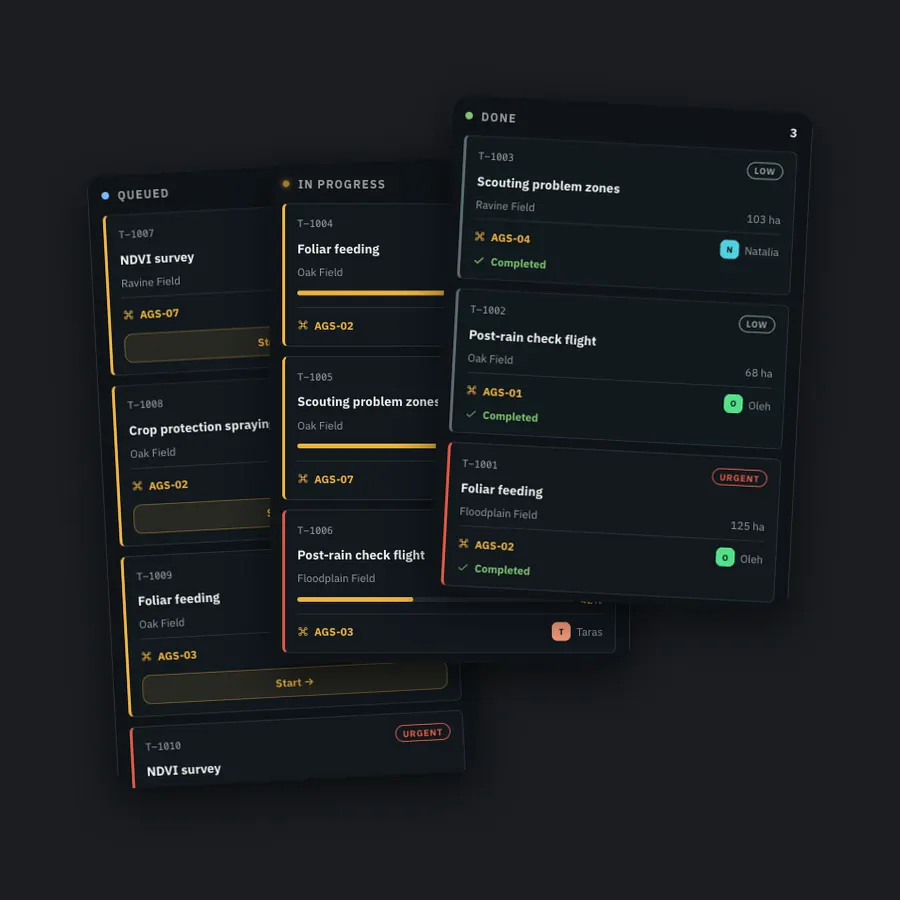
Self-Running Task Board
Surveys, spraying, feeding and check flights queue by priority; a task starts the moment a cleared aircraft frees up and moves to Done by itself.
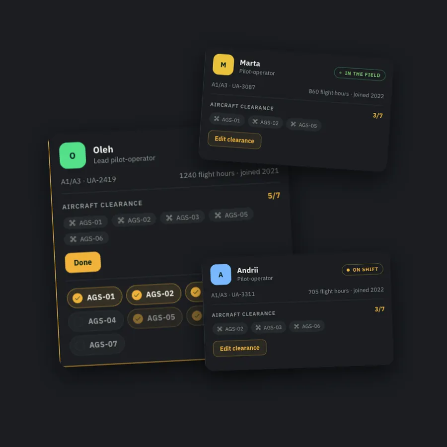
Operators & Aircraft Clearance
Pilots, scouts and technicians with licences and flight hours; an editable clearance matrix decides who may fly which aircraft.
Services and guides behind this project
 WhatsApp
 Telegram